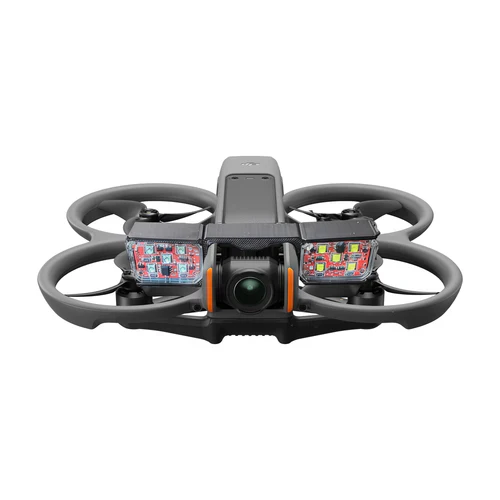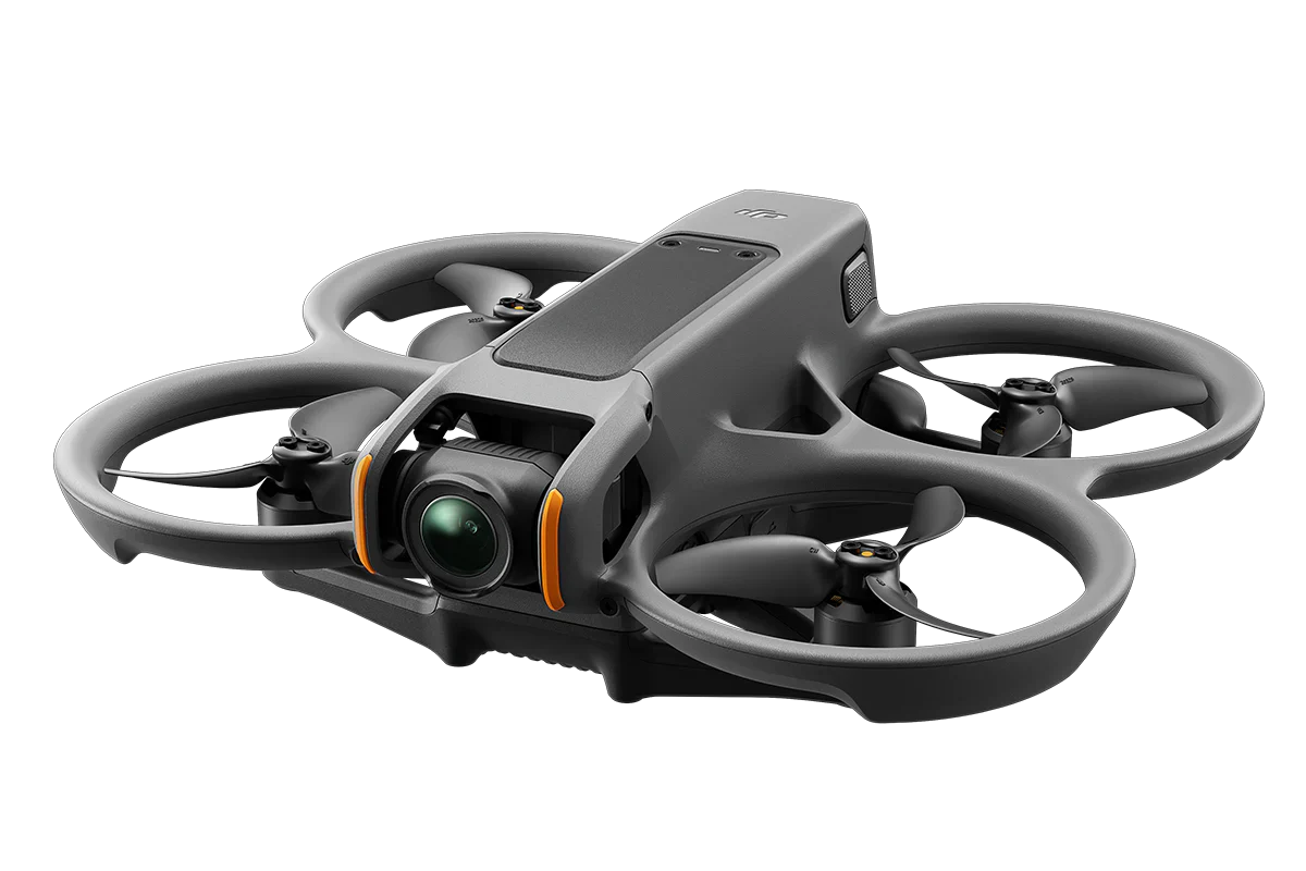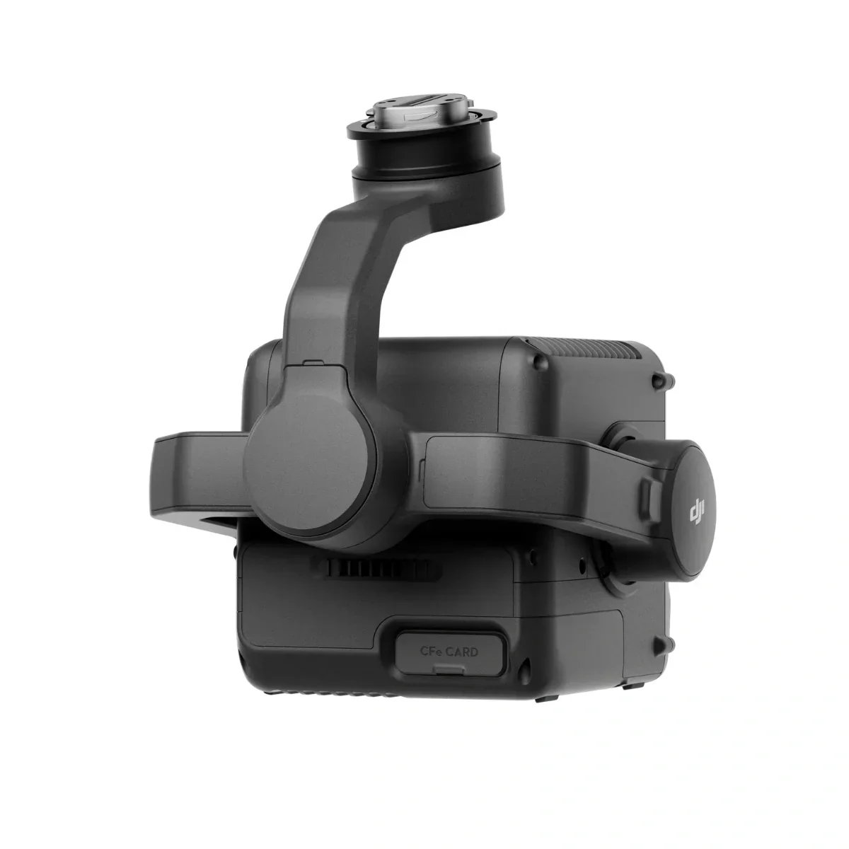
DJI Zenmuse L3 - Long Range LiDAR System Payload
DJI Zenmuse L3 - Long Range LiDAR System Payload
Description
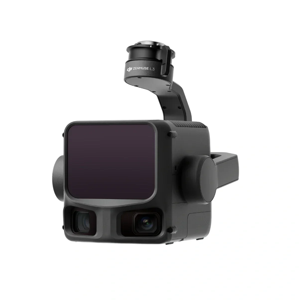
See Through, Far and True
DJI's next-generation high-accuracy aerial LiDAR system features a long-range LiDAR capable of reaching up to 950 m [1] even on objects with just 10% reflectivity. Dual 100MP RGB mapping cameras and a high-precision POS system accelerate geospatial data acquisition, enabling daily coverage of up to 100 km² [2]. Equipped with a 1535 nm Class 1 laser and dual 100 MP Micro 4/3 cameras, it delivers up to 950 m range and 2–4 cm accuracy for professional surveying and digital-twin applications. Built exclusively for the Matrice 400 RTK, the L3 integrates seamlessly into DJI Terra workflows to output point clouds, orthophotos, and 3D models—all within a single processing environment.
Key Features
- 1535nm Long-Range LiDAR
- Dual 100MP RGB Mapping Camera System
- High-efficiency mapping: covers up to 10 km² per flight or 100 km² per day
- Survey-grade accuracy: delivers 2–4 cm precision for mapping applications.
- Adjustable point-rate control: 100 kHz – 2 MHz to balance density and coverage.
- Compact low-power design: 1.6 kg payload draws only 64 W typical power.
- Dual 100 MP Micro 4/3 cameras: generate orthophotos and colorized point clouds.
1535nm Long-Range LiDAR
Zenmuse L3 achieves a maximum detection range of 950 m [1] at a pulse rate of 100 kHz, tested under 100 klx ambient light and on objects with 10% reflectivity. The adjustable pulse rate allows for flexible power output and optimal adaptation to different operational scenarios. Typical flight altitudes of 300 to 500 m significantly [3] expand single-flight coverage and boost mapping efficiency.
Small Spot, High Energy
With a laser beam divergence of just 0.25 mrad (1/e²), the spot size at the same range is about one-fifth that of Zenmuse L2, enabling detection of smaller objects such as power lines and branches. Higher energy density results in stronger penetration capability, significantly increasing ground point density beneath vegetation and enabling high-accuracy reconstruction of complex terrains and structures.
High Pulse Rate, Multiple Returns
With maximum laser pulse emission frequency of 2 million pulses per second and support for up to 16 returns [4], Zenmuse L3 delivers highly accurate spatial reconstruction. Point cloud density and penetration capability can be adjusted to fit needs from high-accuracy mapping to complex environments.
Scanning Modes
Supports Linear, Star-Shaped, and Non-Repetitive scanning modes for different operational scenarios:
• Linear: Achieves more consistent point cloud distribution, ideal for high-accuracy terrain mapping.
• Star-Shaped: Balances accuracy with multiple scan angles and penetration capability, well-suited for forests or dense urban environments.
• Non-Repetitive: Provides multiple scan angles and broader coverage, optimized for power line inspections and other complex structural surveys.
Dual 100MP RGB Mapping Camera System
Dual 100 MP Micro 4/3 sensors with 107° FOV capture ultra-sharp color imagery for photogrammetry and point-cloud colorization. The system delivers 1.2 cm GSD at 120 m AGL or 3 cm GSD at 300 m, ensuring photorealistic results for engineering-grade mapping.
The IP54-rated housing withstands rain, dust, and temperature extremes from -25 °C to +55 °C. Powered by DJI’s unified ecosystem, the L3’s workflow with DJI Terra and Modify offers real-time point-cloud preview, on-site measurement, and automated accuracy checks—all backed by 1-Year DJI Care Enterprise Plus coverage.
High Accuracy
Proprietary High-Precision System
The upgraded high-precision POS system achieves heading accuracy of 0.02° and pitch accuracy of 0.01° (post-processed, 1σ). The self-developed LiDAR delivers ranging repeatability of 5 mm at 150 m (1σ) [5] and supports microsecond-level time synchronization. Each unit undergoes rigorous factory calibration to ensure consistently reliable survey results.
LiDAR Data Accuracy
Vertical accuracy is better than 3 cm at 120m altitude, better than 5 cm at 300 m, and better than 10 cm at 500 m [6], easily supporting mapping projects at 1:500, 1:1000, and 1:2000 scales. The point cloud thickness produced by Zenmuse L3 is only half that of Zenmuse L2, supporting advanced analysis and high-accuracy applications.
High Penetration
High Ground Point Density
With a smaller laser spot and higher single-pulse energy, Zenmuse L3 offers superior penetration capability. In terrain mapping and similar applications, it captures more ground points with greater completeness, significantly improving the accuracy and integrity of terrain data for precise surface fitting and reconstruction.
High Efficiency
When mounted on DJI Matrice 400, Zenmuse L3 delivers outstanding efficiency. At a flight altitude of 300 m, a single flight can cover up to 10 km², enabling up to 100 km² of daily coverage.
Additional Notes
1.
a. Range Definition: The range is defined as the distance at which 50% of the emitted laser pulses are detected. If a laser beam hits more than one subject, the total laser transmitter power is split and the achievable range is reduced.
b. Test Conditions: 100 klx ambient light, within the central area of the FOV, using a flat subject with a size larger than the laser beam diameter, a perpendicular angle of incidence, and an atmospheric visibility of 23 km.
c. The maximum detection range is 900 m by default. For a longer range, contact DJI support or an authorized dealer.
2. When paired with DJI Matrice 400, Zenmuse L3 can achieve a daily mapping coverage of up to 100 km² (flat terrain, 300m nadir flight altitude, 20% side overlap, 17m/s flight speed, and a total effective flight time of 6 hours).
3. The flying altitude limit varies in different countries or regions. Make sure to fly at the altitudes outlined by local laws and regulations.
4. Support for 16 returns is limited to laser pulse emission frequency of 100 kHz and 350 kHz.
5. Tested at 150 m under ambient temperature of 25° C (77° F) and 80% object reflectivity. Actual results may vary depending on environmental and operational conditions. Data is provided for reference only.
6. Measured under the following conditions in a DJI laboratory environment:
a. The field contained objects with obvious angular features. DJI Matrice 400 was linked to a position-calibrated D-RTK 3 Multifunctional Station. The flight route was planned using DJI Pilot 2's Area Route (with Calibrate IMU enabled) with Linear scanning. The flight speed was set to 15 m/s, gimbal pitch to -90°, and each straight segment of the flight route was less than 3300 m.
b. Using exposed hard ground checkpoints that conformed to the diffuse reflection model.
c. DJI Terra was used for post-processing with Optimize Point Cloud Accuracy enabled.
7. For detailed calculation methods, refer to the user manual available on the Downloads page of the official DJI Zenmuse L3 webpage.
8. The service plans offered in different countries or regions may differ. For more information, please consult your local authorized dealer.
Free Repairs: Get free repairs within the coverage scope and limit.
Coverage for Your Whole Fleet: Shared coverage can be extended to other DJI Enterprise devices bound to DJI Care Enterprise Plus within the same time period (30 calendar days) after the first activation and binding.
Free Shipping: Available in regions covered by DJI Care Enterprise. Users are responsible for additional costs including logistics and customs duties incurred beyond the scope of coverage. For specific coverage of components, refer to the After-Sales Service Policy under Support on the DJI official website.
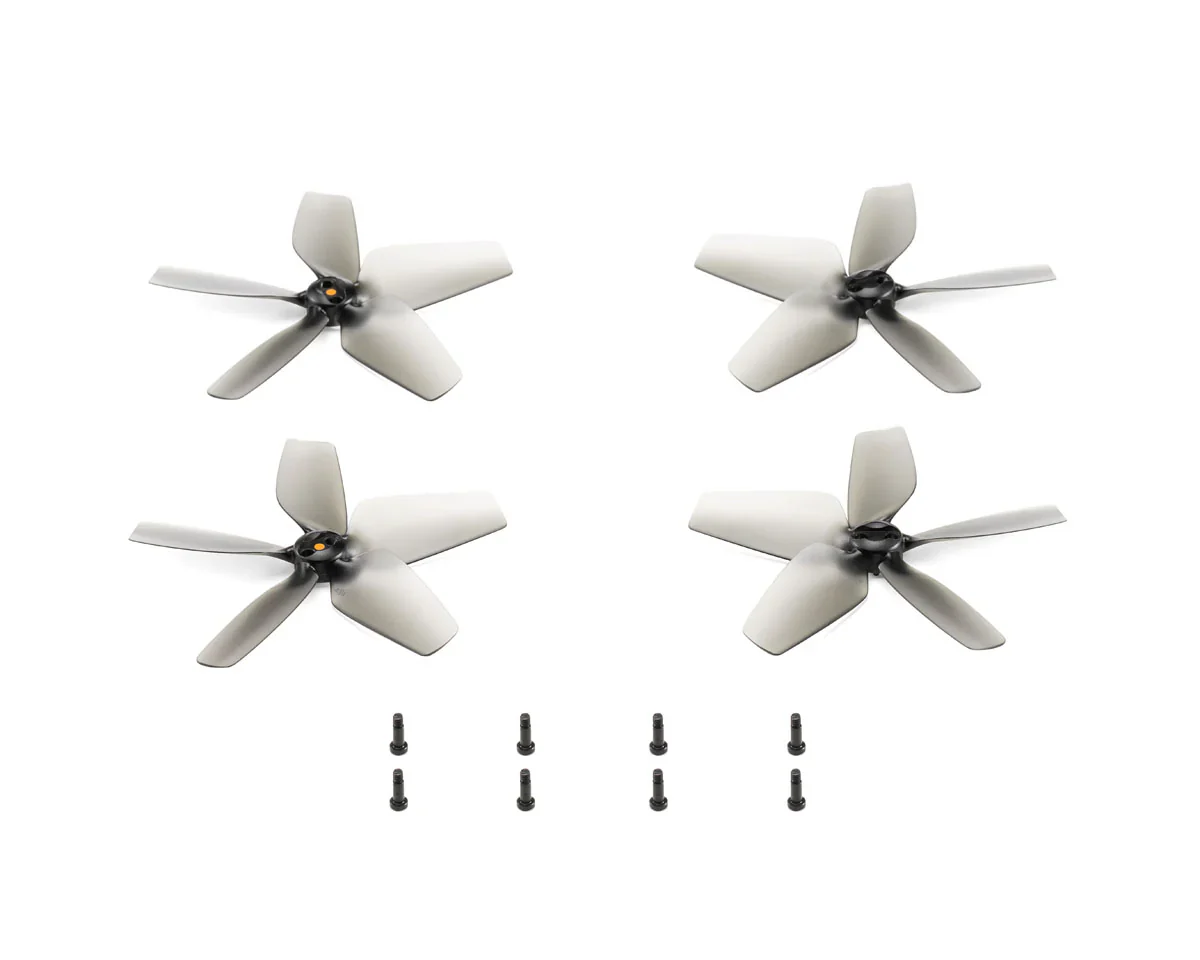
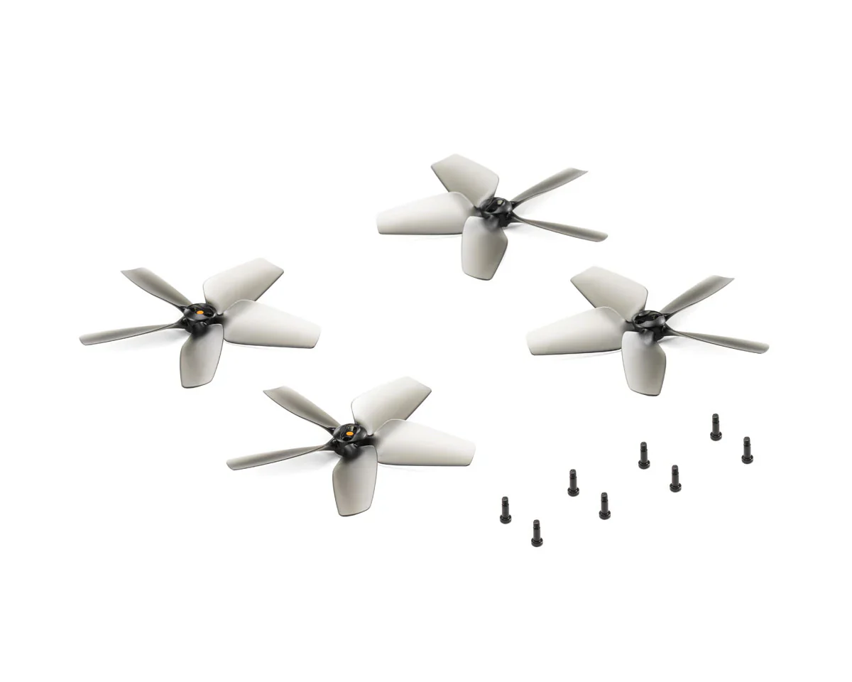
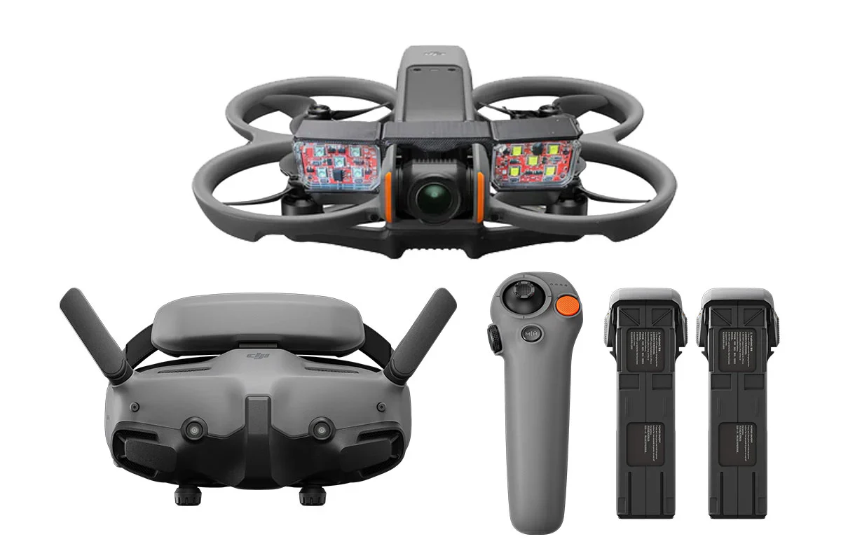
In the Box:
- DJI Zenmuse L3 LiDAR Gimbal Camera
- Single Gimbal Connector
- 2x 1TB CFexpress Type-B Memory Card
- CFexpress Type-B Card Reader
- Storage Case
- Lens Cleaning Cloth
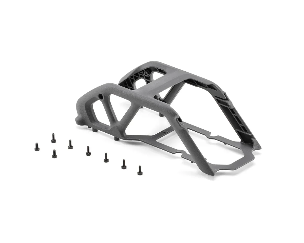
- Matrice 400 Carrying Case Insert
- Screws and Tools
- 4x Gimbal Damper
- Lens Cap
Product Specifications
DJI Zenmuse L3 - Long Range LiDAR System Payload Product Specifications
| Category | Specification | Details |
|---|---|---|
| Product Info | Short Description | DJI's First Long-Range, High-Accuracy Aerial LiDAR System. Designed for the Matrice 400. |
| SKU | CP.EN.00000703.01 | |
| Manufacturer | DJI | |
| Compatible With | DJI Matrice 400 |
Product Manual
Zenmuse L3 - User Manual
Product Warranty
DJI Product Warranty
These DJI After-Sales Policies (these “Policies”) only apply to DJI products (excl. DJI Dock) you purchased from DJI authorized retailers for your own use and not for resale.
These Policies are available in other languages at http://www.dji.com/service. In the event of a conflict between different translations of these terms, the English version shall prevail.
By using your DJI product, you agree to be bound by these Policies. If you are not eligible or do not agree to any of the Terms, do not use your DJI product. You may be entitled to a full refund of your purchase of the Product if you return the inactivated Product in accordance with the Part II of these Policies.
What is Covered
Under this Limited Warranty, DJI warrants that each DJI product (excl. DJI Dock) that you purchase will be free from material and workmanship defects under normal use in accordance with DJI’s published product materials during the warranty period. DJI’s published product materials include, but not limited to, user manuals, safety guidelines, specifications, in-app notifications, and service communications.
The warranty period for different products and parts vary, please check http://www.dji.com/service to verify the duration of the warranty for your particular product or parts. The warranty period for a product starts on the day following the delivery date, If you cannot provide invoice or other valid proof of purchase, then the warranty period will start from 90 days after the shipping date that shows on the product, unless otherwise agreed upon between you and DJI.
How to Obtain Warranty Service
If a product does not function as warranted during the warranty period, you may obtain after-sales service by contacting DJI’s local service center as provided in Part III of these Policies or through http://www.dji.com/support . You will need to provide a valid proof-of-purchase, receipt or order number (for DJI Direct Sales) for the warranty service.
Charges may apply for services not covered by this Limited Warranty. Please contact DJI for information specific to your location.
Please note that the warranty service is only available in the respective DJI service regions where you purchased your DJI product.
What Will DJI Do
DJI will attempt to diagnose and resolve your problem by telephone, e-mail or online chat. DJI may direct you to download and install particular software updates.
If your problem cannot be resolved over the telephone or through the application of software updates, you may be required to deliver the product to DJI for further examination. DJI will arrange for repair or replacement service at no cost if the problem falls under this Limited Warranty.
What These After-Sales Policies Do Not Cover
These policies do not cover the following:
× Crashes or fire damage caused by non-manufacturing factors, including but not limited to, pilot errors.
× Damage caused by unauthorized modification, disassembly, or shell opening not in accordance with DJI’s official instructions or manuals.
× Damage caused by improper installation, incorrect use, or operation not in accordance with DJI’s official instructions or manuals.
× Damage caused by an unauthorized service provider.
× Damage caused by an unauthorized modification of circuits, mismatch, or misuse of battery and charger.
× Damage caused by flights not following recommended instruction manuals.
× Damage caused by operating the product in bad weather (i.e. strong wind, rain, sand or dust storm, etc.).
× Damage caused by operating the product in a surrounding environment with electromagnetic interference (i.e. mining areas, areas with radio transmission towers or high-voltage wires nearby, substations, etc.).
× Damage caused by operating the product in a surrounding environment with wireless interference (i.e. transmitters, video links, Wi-Fi devices, etc.).
× Damage caused by operating the product at a weight greater than the safe takeoff weight as specified in the instruction manuals.
× Damage caused by a forced flight when components have aged or been damaged.
× Damage caused by a reliability or compatibility issue due to use of unauthenticated third-party parts.
× Damage caused by operating the product with a defective battery or at low battery.
× Uninterrupted or error-free operations on the product.
× Loss of, or damage to, your data saved in your product.
× Not provided flight logs which are used for accident data analysis.
× Any software, whether provided with the product or installed subsequently.
× Failures or damage caused by any third-party products, including the products or accessories provided or integrated into your product by DJI at your request.
× Any technical or other support, such as assistance with “how-to” questions or inaccurate product set-up and installation.
× Products or parts with an altered identification label or from which the identification label has been removed.
Limitation of Liability
When receiving service, DJI is responsible for loss or damage to your product only while it is in DJI's possession or in transit, if DJI is responsible for transportation.
Dji is not responsible for loss or disclosure of any data, including confidential information, proprietary information, or personal information, contained in a product.
Dji will not be liable for any failure or delay in performance due to causes beyond DJI's reasonable control (such as fire, explosion, power blackout, earthquake, flood, severe storms, strike, embargo, labor disputes, acts of civil or military authority, war, terrorism (including cyber terrorism), acts of God, acts or omissions of Internet traffic carriers, actions or omissions of regulatory or governmental bodies (including the passage of laws or regulations or other acts of government that impact the delivery of Services)).
Under no circumstances, and notwithstanding the failure of essential purpose of any remedy set forth herein, shall DJI, its affiliates, suppliers, resellers, or service providers be liable for any of the following even if informed of their possibility and regardless of whether the claim is based in contract, warranty, negligence, strict liability or other theory of liability: 1) third party claims against you for damages; 2) loss, damage or disclosure of your data; 3) special, incidental, punitive, indirect or consequential damages, including but not limited to lost profits, business revenue, goodwill or anticipated savings. In no case shall the total liability of DJI, its affiliates, suppliers, resellers, or service providers for damages from any cause exceed the amount of actual direct damages, not to exceed the amount paid for the product.
The foregoing limitation does not apply to damages for bodily injury (including death), damage to real property or damage to tangible personal property for which DJI is liable under law.
As some states or jurisdictions do not allow the exclusion or limitation of incidental or consequential damages, the above limitation or exclusion may not apply to you.
Limitation Of Warranty
To the extent permitted by law, except as expressly provided in this limited warranty, DJI disclaims all warranties of any kind, whether statutory, express or implied, including: (a) any implied warranty of merchantability, fitness for a particular purpose, title, quiet enjoyment, or non-infringement; and (b) any warranty arising out of course of dealing, usage, or trade. The DJI entities do not warrant, except as expressly provided in DJI limited warranty, that the product, product accessories, or any portion of the product, or any materials, will be uninterrupted, secure, or free of errors, viruses, or other harmful components..
Should such warranties cannot be disclaimed, DJI limits the duration and remedies of such warranties to the duration of this express warranty and, at DJI's option, the repair or replacement services provided in this limited warranty.
Some jurisdictions may prohibit a disclaimer of warranties and you may have other rights that vary from jurisdiction to jurisdiction
Your Other Rights
This Limited Warranty provides you with extra and specific legal rights. You may have other rights according to the applicable laws of your state or jurisdiction. You may also have other rights under a written agreement with DJI. Nothing in this Limited Warranty affects your statutory rights, including rights of consumers under laws or regulations governing the sale of consumer products that cannot be waived or limited by agreement.
DJI Warranty
Product FAQs
N/A
Original: $17,400.00
-65%$17,400.00
$6,090.00Product Information
Product Information
Shipping & Returns
Shipping & Returns
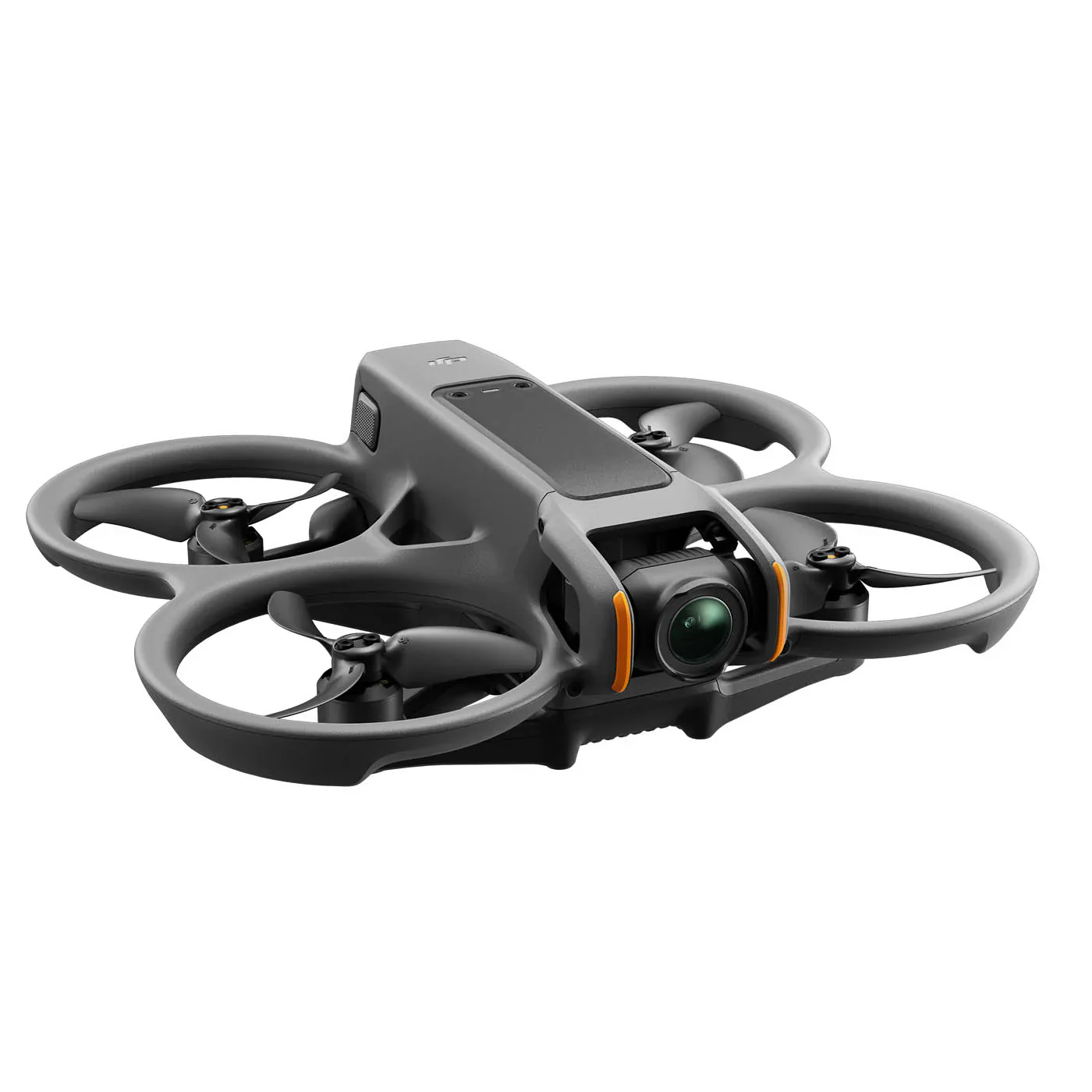
Description
DJI Zenmuse L3 - Long Range LiDAR System Payload
Description
See Through, Far and True
DJI's next-generation high-accuracy aerial LiDAR system features a long-range LiDAR capable of reaching up to 950 m [1] even on objects with just 10% reflectivity. Dual 100MP RGB mapping cameras and a high-precision POS system accelerate geospatial data acquisition, enabling daily coverage of up to 100 km² [2]. Equipped with a 1535 nm Class 1 laser and dual 100 MP Micro 4/3 cameras, it delivers up to 950 m range and 2–4 cm accuracy for professional surveying and digital-twin applications. Built exclusively for the Matrice 400 RTK, the L3 integrates seamlessly into DJI Terra workflows to output point clouds, orthophotos, and 3D models—all within a single processing environment.
Key Features
- 1535nm Long-Range LiDAR
- Dual 100MP RGB Mapping Camera System
- High-efficiency mapping: covers up to 10 km² per flight or 100 km² per day
- Survey-grade accuracy: delivers 2–4 cm precision for mapping applications.
- Adjustable point-rate control: 100 kHz – 2 MHz to balance density and coverage.
- Compact low-power design: 1.6 kg payload draws only 64 W typical power.
- Dual 100 MP Micro 4/3 cameras: generate orthophotos and colorized point clouds.
1535nm Long-Range LiDAR
Zenmuse L3 achieves a maximum detection range of 950 m [1] at a pulse rate of 100 kHz, tested under 100 klx ambient light and on objects with 10% reflectivity. The adjustable pulse rate allows for flexible power output and optimal adaptation to different operational scenarios. Typical flight altitudes of 300 to 500 m significantly [3] expand single-flight coverage and boost mapping efficiency.
Small Spot, High Energy
With a laser beam divergence of just 0.25 mrad (1/e²), the spot size at the same range is about one-fifth that of Zenmuse L2, enabling detection of smaller objects such as power lines and branches. Higher energy density results in stronger penetration capability, significantly increasing ground point density beneath vegetation and enabling high-accuracy reconstruction of complex terrains and structures.
High Pulse Rate, Multiple Returns
With maximum laser pulse emission frequency of 2 million pulses per second and support for up to 16 returns [4], Zenmuse L3 delivers highly accurate spatial reconstruction. Point cloud density and penetration capability can be adjusted to fit needs from high-accuracy mapping to complex environments.
Scanning Modes
Supports Linear, Star-Shaped, and Non-Repetitive scanning modes for different operational scenarios:
• Linear: Achieves more consistent point cloud distribution, ideal for high-accuracy terrain mapping.
• Star-Shaped: Balances accuracy with multiple scan angles and penetration capability, well-suited for forests or dense urban environments.
• Non-Repetitive: Provides multiple scan angles and broader coverage, optimized for power line inspections and other complex structural surveys.
Dual 100MP RGB Mapping Camera System
Dual 100 MP Micro 4/3 sensors with 107° FOV capture ultra-sharp color imagery for photogrammetry and point-cloud colorization. The system delivers 1.2 cm GSD at 120 m AGL or 3 cm GSD at 300 m, ensuring photorealistic results for engineering-grade mapping.
The IP54-rated housing withstands rain, dust, and temperature extremes from -25 °C to +55 °C. Powered by DJI’s unified ecosystem, the L3’s workflow with DJI Terra and Modify offers real-time point-cloud preview, on-site measurement, and automated accuracy checks—all backed by 1-Year DJI Care Enterprise Plus coverage.
High Accuracy
Proprietary High-Precision System
The upgraded high-precision POS system achieves heading accuracy of 0.02° and pitch accuracy of 0.01° (post-processed, 1σ). The self-developed LiDAR delivers ranging repeatability of 5 mm at 150 m (1σ) [5] and supports microsecond-level time synchronization. Each unit undergoes rigorous factory calibration to ensure consistently reliable survey results.
LiDAR Data Accuracy
Vertical accuracy is better than 3 cm at 120m altitude, better than 5 cm at 300 m, and better than 10 cm at 500 m [6], easily supporting mapping projects at 1:500, 1:1000, and 1:2000 scales. The point cloud thickness produced by Zenmuse L3 is only half that of Zenmuse L2, supporting advanced analysis and high-accuracy applications.
High Penetration
High Ground Point Density
With a smaller laser spot and higher single-pulse energy, Zenmuse L3 offers superior penetration capability. In terrain mapping and similar applications, it captures more ground points with greater completeness, significantly improving the accuracy and integrity of terrain data for precise surface fitting and reconstruction.
High Efficiency
When mounted on DJI Matrice 400, Zenmuse L3 delivers outstanding efficiency. At a flight altitude of 300 m, a single flight can cover up to 10 km², enabling up to 100 km² of daily coverage.
Additional Notes
1.
a. Range Definition: The range is defined as the distance at which 50% of the emitted laser pulses are detected. If a laser beam hits more than one subject, the total laser transmitter power is split and the achievable range is reduced.
b. Test Conditions: 100 klx ambient light, within the central area of the FOV, using a flat subject with a size larger than the laser beam diameter, a perpendicular angle of incidence, and an atmospheric visibility of 23 km.
c. The maximum detection range is 900 m by default. For a longer range, contact DJI support or an authorized dealer.
2. When paired with DJI Matrice 400, Zenmuse L3 can achieve a daily mapping coverage of up to 100 km² (flat terrain, 300m nadir flight altitude, 20% side overlap, 17m/s flight speed, and a total effective flight time of 6 hours).
3. The flying altitude limit varies in different countries or regions. Make sure to fly at the altitudes outlined by local laws and regulations.
4. Support for 16 returns is limited to laser pulse emission frequency of 100 kHz and 350 kHz.
5. Tested at 150 m under ambient temperature of 25° C (77° F) and 80% object reflectivity. Actual results may vary depending on environmental and operational conditions. Data is provided for reference only.
6. Measured under the following conditions in a DJI laboratory environment:
a. The field contained objects with obvious angular features. DJI Matrice 400 was linked to a position-calibrated D-RTK 3 Multifunctional Station. The flight route was planned using DJI Pilot 2's Area Route (with Calibrate IMU enabled) with Linear scanning. The flight speed was set to 15 m/s, gimbal pitch to -90°, and each straight segment of the flight route was less than 3300 m.
b. Using exposed hard ground checkpoints that conformed to the diffuse reflection model.
c. DJI Terra was used for post-processing with Optimize Point Cloud Accuracy enabled.
7. For detailed calculation methods, refer to the user manual available on the Downloads page of the official DJI Zenmuse L3 webpage.
8. The service plans offered in different countries or regions may differ. For more information, please consult your local authorized dealer.
Free Repairs: Get free repairs within the coverage scope and limit.
Coverage for Your Whole Fleet: Shared coverage can be extended to other DJI Enterprise devices bound to DJI Care Enterprise Plus within the same time period (30 calendar days) after the first activation and binding.
Free Shipping: Available in regions covered by DJI Care Enterprise. Users are responsible for additional costs including logistics and customs duties incurred beyond the scope of coverage. For specific coverage of components, refer to the After-Sales Service Policy under Support on the DJI official website.
In the Box:
- DJI Zenmuse L3 LiDAR Gimbal Camera
- Single Gimbal Connector
- 2x 1TB CFexpress Type-B Memory Card
- CFexpress Type-B Card Reader
- Storage Case
- Lens Cleaning Cloth
- Matrice 400 Carrying Case Insert
- Screws and Tools
- 4x Gimbal Damper
- Lens Cap
Product Specifications
DJI Zenmuse L3 - Long Range LiDAR System Payload Product Specifications
| Category | Specification | Details |
|---|---|---|
| Product Info | Short Description | DJI's First Long-Range, High-Accuracy Aerial LiDAR System. Designed for the Matrice 400. |
| SKU | CP.EN.00000703.01 | |
| Manufacturer | DJI | |
| Compatible With | DJI Matrice 400 |
Product Manual
Zenmuse L3 - User Manual
Product Warranty
DJI Product Warranty
These DJI After-Sales Policies (these “Policies”) only apply to DJI products (excl. DJI Dock) you purchased from DJI authorized retailers for your own use and not for resale.
These Policies are available in other languages at http://www.dji.com/service. In the event of a conflict between different translations of these terms, the English version shall prevail.
By using your DJI product, you agree to be bound by these Policies. If you are not eligible or do not agree to any of the Terms, do not use your DJI product. You may be entitled to a full refund of your purchase of the Product if you return the inactivated Product in accordance with the Part II of these Policies.
What is Covered
Under this Limited Warranty, DJI warrants that each DJI product (excl. DJI Dock) that you purchase will be free from material and workmanship defects under normal use in accordance with DJI’s published product materials during the warranty period. DJI’s published product materials include, but not limited to, user manuals, safety guidelines, specifications, in-app notifications, and service communications.
The warranty period for different products and parts vary, please check http://www.dji.com/service to verify the duration of the warranty for your particular product or parts. The warranty period for a product starts on the day following the delivery date, If you cannot provide invoice or other valid proof of purchase, then the warranty period will start from 90 days after the shipping date that shows on the product, unless otherwise agreed upon between you and DJI.
How to Obtain Warranty Service
If a product does not function as warranted during the warranty period, you may obtain after-sales service by contacting DJI’s local service center as provided in Part III of these Policies or through http://www.dji.com/support . You will need to provide a valid proof-of-purchase, receipt or order number (for DJI Direct Sales) for the warranty service.
Charges may apply for services not covered by this Limited Warranty. Please contact DJI for information specific to your location.
Please note that the warranty service is only available in the respective DJI service regions where you purchased your DJI product.
What Will DJI Do
DJI will attempt to diagnose and resolve your problem by telephone, e-mail or online chat. DJI may direct you to download and install particular software updates.
If your problem cannot be resolved over the telephone or through the application of software updates, you may be required to deliver the product to DJI for further examination. DJI will arrange for repair or replacement service at no cost if the problem falls under this Limited Warranty.
What These After-Sales Policies Do Not Cover
These policies do not cover the following:
× Crashes or fire damage caused by non-manufacturing factors, including but not limited to, pilot errors.
× Damage caused by unauthorized modification, disassembly, or shell opening not in accordance with DJI’s official instructions or manuals.
× Damage caused by improper installation, incorrect use, or operation not in accordance with DJI’s official instructions or manuals.
× Damage caused by an unauthorized service provider.
× Damage caused by an unauthorized modification of circuits, mismatch, or misuse of battery and charger.
× Damage caused by flights not following recommended instruction manuals.
× Damage caused by operating the product in bad weather (i.e. strong wind, rain, sand or dust storm, etc.).
× Damage caused by operating the product in a surrounding environment with electromagnetic interference (i.e. mining areas, areas with radio transmission towers or high-voltage wires nearby, substations, etc.).
× Damage caused by operating the product in a surrounding environment with wireless interference (i.e. transmitters, video links, Wi-Fi devices, etc.).
× Damage caused by operating the product at a weight greater than the safe takeoff weight as specified in the instruction manuals.
× Damage caused by a forced flight when components have aged or been damaged.
× Damage caused by a reliability or compatibility issue due to use of unauthenticated third-party parts.
× Damage caused by operating the product with a defective battery or at low battery.
× Uninterrupted or error-free operations on the product.
× Loss of, or damage to, your data saved in your product.
× Not provided flight logs which are used for accident data analysis.
× Any software, whether provided with the product or installed subsequently.
× Failures or damage caused by any third-party products, including the products or accessories provided or integrated into your product by DJI at your request.
× Any technical or other support, such as assistance with “how-to” questions or inaccurate product set-up and installation.
× Products or parts with an altered identification label or from which the identification label has been removed.
Limitation of Liability
When receiving service, DJI is responsible for loss or damage to your product only while it is in DJI's possession or in transit, if DJI is responsible for transportation.
Dji is not responsible for loss or disclosure of any data, including confidential information, proprietary information, or personal information, contained in a product.
Dji will not be liable for any failure or delay in performance due to causes beyond DJI's reasonable control (such as fire, explosion, power blackout, earthquake, flood, severe storms, strike, embargo, labor disputes, acts of civil or military authority, war, terrorism (including cyber terrorism), acts of God, acts or omissions of Internet traffic carriers, actions or omissions of regulatory or governmental bodies (including the passage of laws or regulations or other acts of government that impact the delivery of Services)).
Under no circumstances, and notwithstanding the failure of essential purpose of any remedy set forth herein, shall DJI, its affiliates, suppliers, resellers, or service providers be liable for any of the following even if informed of their possibility and regardless of whether the claim is based in contract, warranty, negligence, strict liability or other theory of liability: 1) third party claims against you for damages; 2) loss, damage or disclosure of your data; 3) special, incidental, punitive, indirect or consequential damages, including but not limited to lost profits, business revenue, goodwill or anticipated savings. In no case shall the total liability of DJI, its affiliates, suppliers, resellers, or service providers for damages from any cause exceed the amount of actual direct damages, not to exceed the amount paid for the product.
The foregoing limitation does not apply to damages for bodily injury (including death), damage to real property or damage to tangible personal property for which DJI is liable under law.
As some states or jurisdictions do not allow the exclusion or limitation of incidental or consequential damages, the above limitation or exclusion may not apply to you.
Limitation Of Warranty
To the extent permitted by law, except as expressly provided in this limited warranty, DJI disclaims all warranties of any kind, whether statutory, express or implied, including: (a) any implied warranty of merchantability, fitness for a particular purpose, title, quiet enjoyment, or non-infringement; and (b) any warranty arising out of course of dealing, usage, or trade. The DJI entities do not warrant, except as expressly provided in DJI limited warranty, that the product, product accessories, or any portion of the product, or any materials, will be uninterrupted, secure, or free of errors, viruses, or other harmful components..
Should such warranties cannot be disclaimed, DJI limits the duration and remedies of such warranties to the duration of this express warranty and, at DJI's option, the repair or replacement services provided in this limited warranty.
Some jurisdictions may prohibit a disclaimer of warranties and you may have other rights that vary from jurisdiction to jurisdiction
Your Other Rights
This Limited Warranty provides you with extra and specific legal rights. You may have other rights according to the applicable laws of your state or jurisdiction. You may also have other rights under a written agreement with DJI. Nothing in this Limited Warranty affects your statutory rights, including rights of consumers under laws or regulations governing the sale of consumer products that cannot be waived or limited by agreement.
DJI Warranty
Product FAQs
N/A